İznik Ultra Maratonuİznik, Bursa🇹🇷
Completed
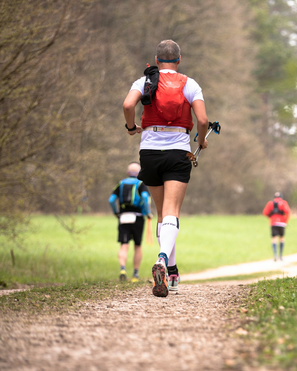
About İznik Ultra Maratonu 2026
İznik Ultra Maratonu 2026 was a trail race held from Fri, Apr 10, 2026 to Sun, Apr 12, 2026 in İznik, Bursa.
The 2026 edition is over; registration is closed. The next edition is added to the calendar automatically once the organiser announces a date.
Courses
| Course | Distance | Start | Elevation Gain | Km-effort |
|---|---|---|---|---|
| 160K | 165.1 km | Fri 17:00 | 4740 m D+ | 213 |
| 90K | 88.1 km | Sat 07:00 | 2780 m D+ | 116 |
| 75K | 76.6 km | Fri 17:00 | 1967 m D+ | 96 |
| 50K | 49 km | Sat 13:00 | 1560 m D+ | 65 |
| 25K | 24.5 km | Sun 09:00 | 340 m D+ | 28 |
| 14K | 14 km | |||
| 5K | 5 km |
There are 7 courses: 160K (165.1 km, 4740 m D+); 90K (88.1 km, 2780 m D+); 75K (76.6 km, 1967 m D+); 50K (49 km, 1560 m D+); 25K (24.5 km, 340 m D+); 14K; 5K.
What the weather was on race day
- On race day the temperature ran 5°C to 11°C, with 1.7 mm of rain through the day, peak wind 15 km/h (a light breeze).
- These figures come from the measurement archive after the race, not from a forecast.
- Sunrise 06:30, sunset 19:34.
The race is over. These figures come from the Open-Meteo measurement archive for that day, not from a forecast.
Race briefing
160K course165 km · 4740 m gain
The station table gives 165 km with 4740 m of climbing, 29 m per km. By leg totals, roughly 42% of the gain sits in the first half.
The steepest leg runs KERAMET to MAHMUDİYE: 8.8 km for 568 m, 65 m per km, 123% above the course average. This is hiking terrain. Walking it costs less than the minutes you would burn forcing it.
The last 4.3 km are easy ground with 11 m left to climb. Plan your finishing pace around that.
These are leg totals. The table does not say where inside a leg the climbing sits, so the steep parts of a leg will be harder than its average.
- Sunset is 19:34 and the finish cut-off is 02:00. A runner using the full time allowance spends the final 10 hours 56 minutes in darkness.
- Get the headtorch out before sunset and keep spare batteries or a power bank dry and immediately accessible. A spare buried at the bottom of the pack is not an emergency spare.
- Check reflective course markers regularly in the dark. If the markings disappear, stop moving forward, return to the last marker and confirm the route against the GPX or organiser app.
- At cut-off pace you run into a second night. Plan the sleep question before race day: an hour gained on the first night costs two on the second.
- Poles are optional: 29 m of gain per km. Bring them to protect your legs, not to gain speed.
The course flow is read from the aid station table published by the organiser; without a GPX file there is no kilometre by kilometre grade profile.
Aid stations
Key decision points
BOYALICAkm 24
- Drinks only; arrive carrying your own food.
- A heavy leg is next: 13 km with 531 m of climbing.
- Cut-off: 3h after the start.
KERAMETkm 37
- A heavy leg is next: 8.8 km with 568 m of climbing.
- Cut-off: 6h 30m after the start.
MAHMUDİYEkm 46
- Drinks only; arrive carrying your own food.
- A heavy leg is next: 21 km with 723 m of climbing.
- The longest unsupported stretch starts here: 21 km. Leave with full capacity.
- Cut-off: 8h 30m after the start.
SÖLÖZkm 92
- The heaviest leg is next: 18 km with 809 m of climbing.
- Cut-off: 17h after the start.
NARLICAkm 109
- A heavy leg is next: 8.9 km with 535 m of climbing.
- Cut-off: 20h 30m after the start.
MÜŞKÜLEkm 118
- Drinks only; arrive carrying your own food.
- A heavy leg is next: 9.8 km with 604 m of climbing.
- Cut-off: 23h after the start.
SÜLEYMANİYEkm 128
- Drinks only; arrive carrying your own food.
- A heavy leg is next: 16 km with 445 m of climbing.
- Cut-off: 25h after the start.
DERBENTkm 144
- A heavy leg is next: 17 km with 299 m of climbing.
- Cut-off: 28h 30m after the start.
- The longest stretch between official aid stations runs from MAHMUDİYE (km 46) to YENİKÖY (km 67): 21 km, with 723 m of climbing in between. Top up at MAHMUDİYE and size what you carry to the expected duration and your own drinking rate.
- Drinks only, no food, at DİKİLİTAŞ (km 9) and BOYALICA (km 24) and 4 more. Loosen the flask caps on approach; with no queue, refill and leave in 20-30 seconds. Carry the food you will need from the previous station.
- The heaviest leg runs from SÖLÖZ (km 92) to NARLICA (km 109): 18 km with 809 m of climbing. Treat it as the slowest part of your day and get your food out before it.
- The overall cut-off is 33h, including all checkpoint stops. Build the plan around the official leg budgets below, not a flat-course average pace.
- Relative to distance and climbing, the tightest official time budget runs from DİKİLİTAŞ (km 9) to BOYALICA (km 24): the official time budget is 1h 20m for 15 km and 83 m of climbing. Station stops come out of that same budget, so do not enter the leg already behind schedule.
Official cut-off ladder
| Leg | Distance | D+ | Official time budget | Closes |
|---|---|---|---|---|
| Start → DİKİLİTAŞ | 8.9 km | 49 m | 1h 40m | start + 1h 40m |
| DİKİLİTAŞ → BOYALICA | 15 km | 83 m | 1h 20m | start + 3h |
| BOYALICA → KERAMET | 13 km | 531 m | 3h 30m | start + 6h 30m |
| KERAMET → MAHMUDİYE | 8.8 km | 568 m | 2h | start + 8h 30m |
| MAHMUDİYE → YENİKÖY | 21 km | 723 m | 3h 30m | start + 12h |
| YENİKÖY → ANAÇAYIR I | 6.4 km | 6 m | 1h 30m | start + 13h 30m |
| ANAÇAYIR I → ÖRNEKKÖY | 3.3 km | 7 m | 0h 30m | start + 14h |
| ÖRNEKKÖY → SÖLÖZ BURNU | 11 km | 22 m | 2h 30m | start + 16h 30m |
| SÖLÖZ BURNU → SÖLÖZ | 4.2 km | 48 m | 0h 30m | start + 17h |
| SÖLÖZ → NARLICA | 18 km | 809 m | 3h 30m | start + 20h 30m |
| NARLICA → MÜŞKÜLE | 8.9 km | 535 m | 2h 30m | start + 23h |
| MÜŞKÜLE → SÜLEYMANİYE | 9.8 km | 604 m | 2h | start + 25h |
| SÜLEYMANİYE → DERBENT | 16 km | 445 m | 3h 30m | start + 28h 30m |
| DERBENT → ÇAMDİBİ | 17 km | 299 m | 3h 30m | start + 32h |
| ÇAMDİBİ → İZNİK | 4.3 km | 11 m | 1h | start + 33h |
Budgets are derived from the cut-off times published by the organiser; they are not a personal finish estimate.
| Station | Km | From previous | Supplies | Cut-off |
|---|---|---|---|---|
| İZNİK | 0 | — | — | Friday 17:05 |
| DİKİLİTAŞ | 8.9 | 8.9 | Water | Friday 18:40 |
| BOYALICA | 24 | 15 | Drinks | Friday 20:00 |
| KERAMET | 37 | 13 | — | Friday 23:30 |
| MAHMUDİYE | 46 | 8.8 | Drinks | Saturday 01:30 |
| YENİKÖY | 67 | 21 | — | Saturday 05:00 |
| ANAÇAYIR I | 73 | 6.4 | — | Saturday 06:30 |
| ÖRNEKKÖY | 77 | 3.3 | — | Saturday 07:00 |
| SÖLÖZ BURNU | 88 | 11 | — | Saturday 09:30 |
| SÖLÖZ | 92 | 4.2 | — | Saturday 10:00 |
| NARLICA | 109 | 18 | — | Saturday 13:30 |
| MÜŞKÜLE | 118 | 8.9 | Water | Saturday 16:00 |
| SÜLEYMANİYE | 128 | 9.8 | Drinks | Saturday 18:00 |
| DERBENT | 144 | 16 | — | Saturday 21:30 |
| ÇAMDİBİ | 161 | 17 | Drinks | Sunday 01:00 |
| İZNİK | 165 | 4.3 | Food | Sunday 02:00 |
Aid station details come from the list published by the organiser; confirm them at the official source before race day.
90K course88 km · 2773 m gain
The station table gives 88 km with 2773 m of climbing, 31 m per km. By leg totals, roughly 56% of the gain sits in the first half.
Leg by leg: the first 11 km for 22 m (SÖLÖZ BURNU), the next 4.2 km for 48 m (SÖLÖZ), the next 18 km for 809 m (NARLICA), the next 8.9 km for 535 m (MÜŞKÜLE), the next 9.8 km for 604 m (SÜLEYMANİYE), the next 16 km for 445 m (DERBENT), the next 17 km for 299 m (ÇAMDİBİ), the last 3.9 km for 11 m (IZNIK).
The steepest leg runs MÜŞKÜLE to SÜLEYMANİYE: 9.8 km for 604 m, 62 m per km, 99% above the course average. This is hiking terrain. Walking it costs less than the minutes you would burn forcing it.
The last 3.9 km are easy ground with 11 m left to climb. Plan your finishing pace around that.
These are leg totals. The table does not say where inside a leg the climbing sits, so the steep parts of a leg will be harder than its average.
- Sunset is 19:35 and the finish cut-off is 00:00. A runner using the full time allowance spends the final 4 hours 25 minutes in darkness.
- Get the headtorch out before sunset and keep spare batteries or a power bank dry and immediately accessible. A spare buried at the bottom of the pack is not an emergency spare.
- Check reflective course markers regularly in the dark. If the markings disappear, stop moving forward, return to the last marker and confirm the route against the GPX or organiser app.
- Poles are strongly recommended for this profile. The table gives 31 m of gain per km and the heaviest leg runs at 62 m per km. If you have trained with them and the organiser allows them, they can help share the load on the climbs.
The course flow is read from the aid station table published by the organiser; without a GPX file there is no kilometre by kilometre grade profile.
Aid stations
Key decision points
SÖLÖZkm 15
- The heaviest leg is next: 18 km with 809 m of climbing.
- The longest unsupported stretch starts here: 18 km. Leave with full capacity.
- Cut-off: 2h 30m after the start.
NARLICAkm 33
- A heavy leg is next: 8.9 km with 535 m of climbing.
- Cut-off: 5h after the start.
MÜŞKÜLEkm 42
- Drinks only; arrive carrying your own food.
- A heavy leg is next: 9.8 km with 604 m of climbing.
- Cut-off: 6h 30m after the start.
SÜLEYMANİYEkm 51
- Drinks only; arrive carrying your own food.
- A heavy leg is next: 16 km with 445 m of climbing.
- Cut-off: 9h after the start.
DERBENTkm 68
- A heavy leg is next: 17 km with 299 m of climbing.
- Cut-off: 14h 30m after the start.
- The longest stretch between official aid stations runs from SÖLÖZ (km 15) to NARLICA (km 33): 18 km, with 809 m of climbing in between. Top up at SÖLÖZ and size what you carry to the expected duration and your own drinking rate.
- Drinks only, no food, at MÜŞKÜLE (km 42) and SÜLEYMANİYE (km 51) and 1 more. Loosen the flask caps on approach; with no queue, refill and leave in 20-30 seconds. Carry the food you will need from the previous station.
- Another heavy leg runs from MÜŞKÜLE (km 42) to SÜLEYMANİYE (km 51): 10 km with 604 m of climbing. Treat it as the slowest part of your day and get your food out before it.
- The overall cut-off is 17h, including all checkpoint stops. Build the plan around the official leg budgets below, not a flat-course average pace.
- Relative to distance and climbing, the tightest official time budget runs from DERBENT (km 68) to ÇAMDİBİ (km 84): the official time budget is 1h 30m for 17 km and 299 m of climbing. Station stops come out of that same budget, so do not enter the leg already behind schedule.
Official cut-off ladder
| Leg | Distance | D+ | Official time budget | Closes |
|---|---|---|---|---|
| Start → SÖLÖZ BURNU | 11 km | 22 m | 1h 45m | start + 1h 45m |
| SÖLÖZ BURNU → SÖLÖZ | 4.2 km | 48 m | 0h 45m | start + 2h 30m |
| SÖLÖZ → NARLICA | 18 km | 809 m | 2h 30m | start + 5h |
| NARLICA → MÜŞKÜLE | 8.9 km | 535 m | 1h 30m | start + 6h 30m |
| MÜŞKÜLE → SÜLEYMANİYE | 9.8 km | 604 m | 2h 30m | start + 9h |
| SÜLEYMANİYE → DERBENT | 16 km | 445 m | 5h 30m | start + 14h 30m |
| DERBENT → ÇAMDİBİ | 17 km | 299 m | 1h 30m | start + 16h |
| ÇAMDİBİ → IZNIK | 3.9 km | 11 m | 1h | start + 17h |
Budgets are derived from the cut-off times published by the organiser; they are not a personal finish estimate.
| Station | Km | From previous | Supplies | Cut-off |
|---|---|---|---|---|
| ÖRNEKKÖY | 0 | — | — | Saturday 07:05 |
| SÖLÖZ BURNU | 11 | 11 | — | Saturday 08:45 |
| SÖLÖZ | 15 | 4.2 | — | Saturday 09:30 |
| NARLICA | 33 | 18 | — | Saturday 12:00 |
| MÜŞKÜLE | 42 | 8.9 | Water | Saturday 13:30 |
| SÜLEYMANİYE | 51 | 9.8 | Drinks | Saturday 16:00 |
| DERBENT | 68 | 16 | — | Saturday 21:30 |
| ÇAMDİBİ | 84 | 17 | Drinks | Saturday 23:00 |
| IZNIK | 88 | 3.9 | Food | Sunday 00:00 |
Aid station details come from the list published by the organiser; confirm them at the official source before race day.
75K course77 km · 1967 m gain
The station table gives 77 km with 1967 m of climbing, 26 m per km. By leg totals, roughly 38% of the gain sits in the first half.
Leg by leg: the first 8.9 km for 49 m (DİKİLİTAŞ), the next 15 km for 83 m (BOYALICA), the next 13 km for 531 m (KERAMET), the next 8.8 km for 568 m (MAHMUDİYE), the next 21 km for 723 m (YENİKÖY), the next 6.4 km for 6 m (ANAÇAYIRI), the last 3.3 km for 7 m (ÖRNEKKÖY).
The steepest leg runs KERAMET to MAHMUDİYE: 8.8 km for 568 m, 65 m per km, 148% above the course average. This is hiking terrain. Walking it costs less than the minutes you would burn forcing it.
The last 3.3 km are easy ground with 7 m left to climb. Plan your finishing pace around that.
These are leg totals. The table does not say where inside a leg the climbing sits, so the steep parts of a leg will be harder than its average.
- Sunset is 19:34 and the finish cut-off is 07:00. A runner using the full time allowance spends the final 10 hours 56 minutes in darkness.
- Get the headtorch out before sunset and keep spare batteries or a power bank dry and immediately accessible. A spare buried at the bottom of the pack is not an emergency spare.
- Check reflective course markers regularly in the dark. If the markings disappear, stop moving forward, return to the last marker and confirm the route against the GPX or organiser app.
- Poles are optional: 26 m of gain per km. Bring them to protect your legs, not to gain speed.
- Most of the climbing waits in the second half. Feeling good early is a trap here.
The course flow is read from the aid station table published by the organiser; without a GPX file there is no kilometre by kilometre grade profile.
Aid stations
Key decision points
BOYALICAkm 24
- Drinks only; arrive carrying your own food.
- A heavy leg is next: 13 km with 531 m of climbing.
- Cut-off: 3h after the start.
KERAMETkm 37
- A heavy leg is next: 8.8 km with 568 m of climbing.
- Cut-off: 6h 30m after the start.
MAHMUDİYEkm 46
- Drinks only; arrive carrying your own food.
- The heaviest leg is next: 21 km with 723 m of climbing.
- The longest unsupported stretch starts here: 21 km. Leave with full capacity.
- Cut-off: 8h 30m after the start.
- The longest stretch between official aid stations runs from MAHMUDİYE (km 46) to YENİKÖY (km 67): 21 km, with 723 m of climbing in between. Top up at MAHMUDİYE and size what you carry to the expected duration and your own drinking rate.
- Drinks only, no food, at DİKİLİTAŞ (km 9) and BOYALICA (km 24) and 1 more. Loosen the flask caps on approach; with no queue, refill and leave in 20-30 seconds. Carry the food you will need from the previous station.
- Another heavy leg runs from KERAMET (km 37) to MAHMUDİYE (km 46): 9 km with 568 m of climbing. Treat it as the slowest part of your day and get your food out before it.
- The overall cut-off is 14h, including all checkpoint stops. Build the plan around the official leg budgets below, not a flat-course average pace.
- Relative to distance and climbing, the tightest official time budget runs from DİKİLİTAŞ (km 9) to BOYALICA (km 24): the official time budget is 1h 20m for 15 km and 83 m of climbing. Station stops come out of that same budget, so do not enter the leg already behind schedule.
Official cut-off ladder
| Leg | Distance | D+ | Official time budget | Closes |
|---|---|---|---|---|
| Start → DİKİLİTAŞ | 8.9 km | 49 m | 1h 40m | start + 1h 40m |
| DİKİLİTAŞ → BOYALICA | 15 km | 83 m | 1h 20m | start + 3h |
| BOYALICA → KERAMET | 13 km | 531 m | 3h 30m | start + 6h 30m |
| KERAMET → MAHMUDİYE | 8.8 km | 568 m | 2h | start + 8h 30m |
| MAHMUDİYE → YENİKÖY | 21 km | 723 m | 3h 30m | start + 12h |
| YENİKÖY → ANAÇAYIRI | 6.4 km | 6 m | 1h 30m | start + 13h 30m |
| ANAÇAYIRI → ÖRNEKKÖY | 3.3 km | 7 m | 0h 30m | start + 14h |
Budgets are derived from the cut-off times published by the organiser; they are not a personal finish estimate.
| Station | Km | From previous | Supplies | Cut-off |
|---|---|---|---|---|
| İZNİK | 0 | — | — | Friday 17:05 |
| DİKİLİTAŞ | 8.9 | 8.9 | Water | Friday 18:40 |
| BOYALICA | 24 | 15 | Drinks | Friday 20:00 |
| KERAMET | 37 | 13 | — | Friday 23:30 |
| MAHMUDİYE | 46 | 8.8 | Drinks | Saturday 01:30 |
| YENİKÖY | 67 | 21 | — | Saturday 05:00 |
| ANAÇAYIRI | 73 | 6.4 | — | Saturday 06:30 |
| ÖRNEKKÖY | 77 | 3.3 | — | Saturday 07:00 |
Aid station details come from the list published by the organiser; confirm them at the official source before race day.
50K course49 km · 1559 m gain
The station table gives 49 km with 1559 m of climbing, 32 m per km. By leg totals, roughly 73% of the gain sits in the first half.
Leg by leg: the first 2.5 km for 200 m (MÜŞKÜLE), the next 9.8 km for 604 m (SÜLEYMANİYE), the next 16 km for 445 m (DERBENT), the next 17 km for 299 m (ÇAMDİBİ), the last 3.9 km for 11 m (İZNİK).
The steepest leg runs MÜŞKÜLE to MÜŞKÜLE: 2.5 km for 200 m, 80 m per km, 150% above the course average. This is hiking terrain. Walking it costs less than the minutes you would burn forcing it.
The last 3.9 km are easy ground with 11 m left to climb. Plan your finishing pace around that.
These are leg totals. The table does not say where inside a leg the climbing sits, so the steep parts of a leg will be harder than its average.
- Sunset is 19:35 and the finish cut-off is 23:00. A runner using the full time allowance spends the final 3 hours 25 minutes in darkness.
- Get the headtorch out before sunset and keep spare batteries or a power bank dry and immediately accessible. A spare buried at the bottom of the pack is not an emergency spare.
- Check reflective course markers regularly in the dark. If the markings disappear, stop moving forward, return to the last marker and confirm the route against the GPX or organiser app.
- Poles are strongly recommended for this profile. The table gives 32 m of gain per km and the heaviest leg runs at 80 m per km. If you have trained with them and the organiser allows them, they can help share the load on the climbs.
- 73% of the climbing is in the first half. Start easy; less climbing later does not remove the cost of the descents and accumulated fatigue.
The course flow is read from the aid station table published by the organiser; without a GPX file there is no kilometre by kilometre grade profile.
Aid stations
Key decision points
MÜŞKÜLEkm 2.5
- Drinks only; arrive carrying your own food.
- The heaviest leg is next: 9.8 km with 604 m of climbing.
- Cut-off: 0h 45m after the start.
SÜLEYMANİYEkm 12
- Drinks only; arrive carrying your own food.
- A heavy leg is next: 16 km with 445 m of climbing.
- Cut-off: 2h 45m after the start.
DERBENTkm 28
- A heavy leg is next: 17 km with 299 m of climbing.
- The longest unsupported stretch starts here: 17 km. Leave with full capacity.
- Cut-off: 6h 15m after the start.
- The longest stretch between official aid stations runs from DERBENT (km 28) to ÇAMDİBİ (km 45): 17 km, with 299 m of climbing in between. Top up at DERBENT and size what you carry to the expected duration and your own drinking rate.
- Drinks only, no food, at MÜŞKÜLE (km 3) and SÜLEYMANİYE (km 12) and 1 more. Loosen the flask caps on approach; with no queue, refill and leave in 20-30 seconds. Carry the food you will need from the previous station.
- The heaviest leg runs from MÜŞKÜLE (km 3) to SÜLEYMANİYE (km 12): 10 km with 604 m of climbing. Treat it as the slowest part of your day and get your food out before it.
- The overall cut-off is 10h, including all checkpoint stops. Build the plan around the official leg budgets below, not a flat-course average pace.
- Relative to distance and climbing, the tightest official time budget runs from MÜŞKÜLE (km 3) to SÜLEYMANİYE (km 12): the official time budget is 2h for 10 km and 604 m of climbing. Station stops come out of that same budget, so do not enter the leg already behind schedule.
Official cut-off ladder
| Leg | Distance | D+ | Official time budget | Closes |
|---|---|---|---|---|
| Start → MÜŞKÜLE | 2.5 km | 200 m | 0h 45m | start + 0h 45m |
| MÜŞKÜLE → SÜLEYMANİYE | 9.8 km | 604 m | 2h | start + 2h 45m |
| SÜLEYMANİYE → DERBENT | 16 km | 445 m | 3h 30m | start + 6h 15m |
| DERBENT → ÇAMDİBİ | 17 km | 299 m | 3h | start + 9h 15m |
| ÇAMDİBİ → İZNİK | 3.9 km | 11 m | 0h 45m | start + 10h |
Budgets are derived from the cut-off times published by the organiser; they are not a personal finish estimate.
| Station | Km | From previous | Supplies | Cut-off |
|---|---|---|---|---|
| MÜŞKÜLE | 0 | — | — | Saturday 13:05 |
| MÜŞKÜLE | 2.5 | 2.5 | Water | Saturday 13:45 |
| SÜLEYMANİYE | 12 | 9.8 | Drinks | Saturday 15:45 |
| DERBENT | 28 | 16 | — | Saturday 19:15 |
| ÇAMDİBİ | 45 | 17 | Drinks | Saturday 22:15 |
| İZNİK | 49 | 3.9 | Food | Saturday 23:00 |
Aid station details come from the list published by the organiser; confirm them at the official source before race day.
25K course25 km · 358 m gain
The station table gives 25 km with 358 m of climbing, 15 m per km. By leg totals, roughly 55% of the gain sits in the first half.
Leg by leg: the first 3.9 km for 48 m (DERBENT), the next 17 km for 299 m (ÇAMDİBİ), the last 3.9 km for 11 m (IZNIK).
The steepest leg runs DERBENT to ÇAMDİBİ: 17 km for 299 m, 18 m per km. A gentle gradient: this is the leg where the time comes back.
The last 3.9 km are easy ground with 11 m left to climb. Plan your finishing pace around that.
These are leg totals. The table does not say where inside a leg the climbing sits, so the steep parts of a leg will be harder than its average.
- Even at cut-off pace you finish 5 hours 36 minutes before sunset. This one is run entirely in daylight.
- The table does not show a clear need for poles: 15 m of gain per km. If you are not used to them, running with your hands free may be more comfortable.
The course flow is read from the aid station table published by the organiser; without a GPX file there is no kilometre by kilometre grade profile.
Aid stations
Key decision points
DERBENTkm 3.9
- The heaviest leg is next: 17 km with 299 m of climbing.
- The longest unsupported stretch starts here: 17 km. Leave with full capacity.
- Cut-off: 0h 50m after the start.
- The longest stretch between official aid stations runs from DERBENT (km 4) to ÇAMDİBİ (km 21): 17 km, with 299 m of climbing in between. Top up at DERBENT and size what you carry to the expected duration and your own drinking rate.
- Drinks only, no food, at ÇAMDİBİ (km 21). Loosen the flask caps on approach; with no queue, refill and leave in 20-30 seconds. Carry the food you will need from the previous station.
- The overall cut-off is 5h, including all checkpoint stops. Build the plan around the official leg budgets below, not a flat-course average pace.
- Relative to distance and climbing, the tightest official time budget runs from DERBENT (km 4) to ÇAMDİBİ (km 21): the official time budget is 3h 10m for 17 km and 299 m of climbing. Station stops come out of that same budget, so do not enter the leg already behind schedule.
| Station | Km | From previous | Supplies | Cut-off |
|---|---|---|---|---|
| DERBENT | 0 | — | — | Sunday 09:05 |
| DERBENT | 3.9 | 3.9 | — | Sunday 09:50 |
| ÇAMDİBİ | 21 | 17 | Drinks | Sunday 13:00 |
| IZNIK | 25 | 3.9 | Food | Sunday 14:00 |
Aid station details come from the list published by the organiser; confirm them at the official source before race day.
Calculators for this race
Data sources: Yarış Radarı editorial entry, official site (iznikultra.com)
Organising this race? See how to correct details and complete this page
Similar races
Frequently asked questions
(26)
What is İznik Ultra Maratonu?
İznik Ultra Maratonu: Fri, Apr 10, 2026, Bursa. Date, courses and registration details for this Trail race.
When is İznik Ultra Maratonu 2026?
İznik Ultra Maratonu takes place on Fri, Apr 10, 2026 - Sun, Apr 12, 2026.
Where does İznik Ultra Maratonu take place?
İznik Ultra Maratonu takes place in İznik, Bursa.
What are the courses and distances of İznik Ultra Maratonu 2026?
İznik Ultra Maratonu offers 7 courses: 160K (165.1 km, 4740 m D+); 90K (88.1 km, 2780 m D+); 75K (76.6 km, 1967 m D+); 50K (49 km, 1560 m D+); 25K (24.5 km, 340 m D+); 14K (14 km); 5K (5 km).
How hard is İznik Ultra Maratonu 2026?
Difficulty is measured in km-effort: distance plus ascent divided by 100. The 160K course covers 165.1 km with 4740 m of climbing, which is 213 km-effort and falls in ITRA category XXL. All courses: 160K 213 km-effort (XXL), 90K 116 km-effort (L), 75K 96 km-effort (M), 50K 65 km-effort (S), 25K 28 km-effort (XS).
Is registration for İznik Ultra Maratonu 2026 open?
The 2026 edition has taken place; registration is closed. Follow the official site and Yarış Radarı for the next edition: https://yarisradari.com/en/yaris/iznik-ultra-maratonu
Where are the İznik Ultra Maratonu 2026 results?
The İznik Ultra Maratonu 2026 result list is published by the organiser at: https://sonuc.plustiming.com/Results.aspx?CId=16389&RId=300&EId=1
Where are the İznik Ultra Maratonu photos?
İznik Ultra Maratonu photos are in the organiser's gallery: https://www.iznikultra.com/tr/galeri/genel. The gallery may also cover earlier editions.
What is the official website of İznik Ultra Maratonu?
Official website: https://www.iznikultra.com/
Where is the hardest section at İznik Ultra Maratonu 2026?
The steepest leg of the 160K course runs km 37 to km 46: 8.8 km for 568 m, 65 m per km. The figures come from the organiser's aid station table.
How much climbing does İznik Ultra Maratonu 2026 have?
The 160K course covers 165 km with 4740 m of climbing according to the station table, 29 m per km.
Do you need poles at İznik Ultra Maratonu 2026?
The 160K course averages 29 m of gain per km. Poles are optional here.
Do you need a headtorch at İznik Ultra Maratonu 2026?
160K: Sunset is 19:34 and the finish cut-off is 02:00. A runner using the full time allowance spends the final 10 hours 56 minutes in darkness. Get the headtorch out before sunset and keep spare batteries or a power bank dry and immediately accessible. A spare buried at the bottom of the pack is not an emergency spare. Check reflective course markers regularly in the dark. If the markings disappear, stop moving forward, return to the last marker and confirm the route against the GPX or organiser app. At cut-off pace you run into a second night. Plan the sleep question before race day: an hour gained on the first night costs two on the second.
What was the weather like at İznik Ultra Maratonu 2026?
On race day the temperature ran 5°C to 11°C, with 1.7 mm of rain, peak wind 15 km/h. These figures come from the measurement archive.
Where are the aid stations at İznik Ultra Maratonu 2026?
The 160K course has 14 stations; the first at km 9 and the last at km 161. The longest gap between them is 21 km, between MAHMUDİYE and YENİKÖY.
What is served at the İznik Ultra Maratonu 2026 aid stations?
For the 160K course: Drinks only: DİKİLİTAŞ (9. km), MÜŞKÜLE (118. km), BOYALICA (24. km), MAHMUDİYE (46. km), SÜLEYMANİYE (128. km), ÇAMDİBİ (161. km).
What are the cut-off times for the 160K at İznik Ultra Maratonu 2026?
On the 160K course at İznik Ultra Maratonu 2026 the finish cut-off is Sunday 02:00. Intermediate cut-offs: DİKİLİTAŞ (km 9) Friday 18:40, BOYALICA (km 24) Friday 20:00, KERAMET (km 37) Friday 23:30, MAHMUDİYE (km 46) Saturday 01:30, YENİKÖY (km 67) Saturday 05:00, ANAÇAYIR I (km 73) Saturday 06:30, ÖRNEKKÖY (km 77) Saturday 07:00, SÖLÖZ BURNU (km 88) Saturday 09:30, SÖLÖZ (km 92) Saturday 10:00, NARLICA (km 109) Saturday 13:30, MÜŞKÜLE (km 118) Saturday 16:00, SÜLEYMANİYE (km 128) Saturday 18:00, DERBENT (km 144) Saturday 21:30, ÇAMDİBİ (km 161) Sunday 01:00.
What are the cut-off times for the 90K at İznik Ultra Maratonu 2026?
On the 90K course at İznik Ultra Maratonu 2026 the finish cut-off is Sunday 00:00. Intermediate cut-offs: SÖLÖZ BURNU (km 11) Saturday 08:45, SÖLÖZ (km 15) Saturday 09:30, NARLICA (km 33) Saturday 12:00, MÜŞKÜLE (km 42) Saturday 13:30, SÜLEYMANİYE (km 51) Saturday 16:00, DERBENT (km 68) Saturday 21:30, ÇAMDİBİ (km 84) Saturday 23:00.
What are the cut-off times for the 75K at İznik Ultra Maratonu 2026?
On the 75K course at İznik Ultra Maratonu 2026 the finish cut-off is Saturday 07:00. Intermediate cut-offs: DİKİLİTAŞ (km 9) Friday 18:40, BOYALICA (km 24) Friday 20:00, KERAMET (km 37) Friday 23:30, MAHMUDİYE (km 46) Saturday 01:30, YENİKÖY (km 67) Saturday 05:00, ANAÇAYIRI (km 73) Saturday 06:30.
What are the cut-off times for the 50K at İznik Ultra Maratonu 2026?
On the 50K course at İznik Ultra Maratonu 2026 the finish cut-off is Saturday 23:00. Intermediate cut-offs: MÜŞKÜLE (km 3) Saturday 13:45, SÜLEYMANİYE (km 12) Saturday 15:45, DERBENT (km 28) Saturday 19:15, ÇAMDİBİ (km 45) Saturday 22:15.
What time does İznik Ultra Maratonu 2026 start?
Known start times: 160K 17:00, 90K 07:00, 75K 17:00, 50K 13:00, 25K 09:00, local time. Confirm against the organiser's schedule in race week.
What is the time limit at İznik Ultra Maratonu 2026?
The finish time limit is 160K Sunday 02:00, 90K Sunday 00:00, 75K Saturday 07:00, 50K Saturday 23:00, 25K Sunday 14:00. Intermediate stations carry their own cut-offs; the full list is in the checkpoint table on this page.
Which İznik Ultra Maratonu course should you choose?
The shortest option is 5K (5 km) and the longest is 160K (165.1 km, 4740 m D+). With little trail experience the 5K is the safer start; the 160K demands an all-day effort and cut-off management.
Do you need to carry water at İznik Ultra Maratonu 2026?
Yes: the longest stretch without aid on the 160K course is 21.2 km, so carrying backup water is essential.
When is İznik Ultra Maratonu 2027?
The date for İznik Ultra Maratonu 2027 has not been announced yet. It will appear on this page once the organiser confirms it: https://yarisradari.com/en/yaris/iznik-ultra-maratonu
Will İznik Ultra Maratonu 2026 take place?
İznik Ultra Maratonu status: Completed.