Snowbasin by UTMBOgden, United States🇺🇸
Completed

About Snowbasin by UTMB 2026
Snowbasin by UTMB 2026 was a trail race held from Thu, Sep 10, 2026 to Sat, Sep 12, 2026 in Ogden, United States; the start is at 07:00.
The 2026 edition is over; registration is closed. The next edition is added to the calendar automatically once the organiser announces a date.
Set at the heart of Snowbasin Resort, this alpine retreat in the Northern Wasatch is framed by sweeping ridgelines, forested slopes, and expansive views stretching toward the Great Salt Lake. Thoughtful, boutique-scale details create an atmosphere that feels refined, welcoming, and deeply connected to the Wasatch landscape. On race day, flowing, runnable trails wind through sagebrush, aspen groves, evergreen forests, and open mountain terrain. The elevation profile is challenging yet achievable, rewarding rhythm and strategy as much as strength, with every climb unveiling breathtaking panoramas.
Courses
There are 2 courses: 59K (1800 m D+); 29K (800 m D+).
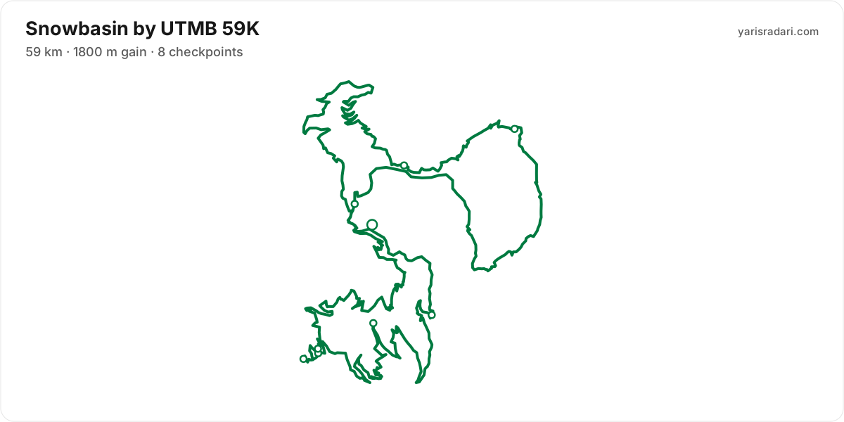
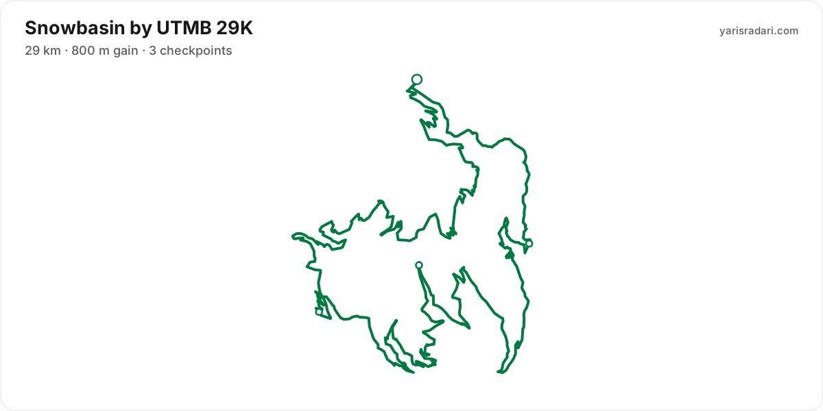
Course map and elevation profile
What the weather was on race day
- On race day the temperature ran 7°C to 25°C, and the day stayed dry, peak wind 13 km/h (a light breeze).
- These figures come from the measurement archive after the race, not from a forecast.
- Sunrise 07:02, sunset 19:44. You start in the dark, so a headtorch is not optional.
The race is over. These figures come from the Open-Meteo measurement archive for that day, not from a forecast.
Race briefing
59K course58 km · 1650 m gain · 8 aid stations
The station table gives 58 km with 1650 m of climbing, 28 m per km. The same table lists 1648 m of descent. By leg totals, roughly 53% of the gain sits in the first half.
The steepest leg runs Needles 1 to Needles Overlook: 0.9 km for 121 m, 137 m per km, 391% above the course average. This is hiking terrain. Walking it costs less than the minutes you would burn forcing it.
The last 13 km still climb 465 m, 35 m per km. It does not end where you first see the finish banner, so save something for it.
These are leg totals. The table does not say where inside a leg the climbing sits, so the steep parts of a leg will be harder than its average.
- The organiser lists 59 km; the published GPX measures 58 km. The organiser lists 1800 m of climbing; the aid-station legs add up to 1650 m. The course notes use the GPX for route shape and the aid-station table for climbing.
- Cut-off lands at 19:00 and sunset at 19:44, near enough the same moment. Go slower than planned and the last kilometres are in the dark, so pack the torch.
- Poles are optional: 28 m of gain per km. Bring them to protect your legs, not to gain speed.
- The route passes the start area 2 times, but the loops differ; the later section is ground you have not seen.
- At km 28.6 you pass right by the finish area with 29.4 km still to go; the noise there breaks more races than the climbs do.
The organiser's GPX file has no elevation data, so the grade profile and kilometre analysis cannot be shown for this course; climb figures come from the aid station table.
Aid stations
Key decision points
Pre-Sardinekm 45
- Drinks only; arrive carrying your own food.
- The heaviest leg is next: 13 km with 465 m of climbing.
- The longest unsupported stretch starts here: 13 km. Leave with full capacity.
- The longest stretch between official aid stations runs from Pre-Sardine (km 45) to Finish (km 58): 13 km, with 465 m of climbing in between. Top up at Pre-Sardine and size what you carry to the expected duration and your own drinking rate.
- Drinks only, no food, at Green Pond (km 3) and Becker Lift (km 10) and 1 more. Loosen the flask caps on approach; with no queue, refill and leave in 20-30 seconds. Carry the food you will need from the previous station.
- Needles Overlook (km 17) is a timing point only, with nothing on the table. Load up as you leave Needles 1.
- Food is available at Needles 1 (km 17) and Needles 2 (km 19) and 2 more. Decide what you need before reaching the table; without a planned special task, collect food and fluids and leave within 60-90 seconds. Finish eating on the next calm, suitable section.
- Crew support is permitted only at Finish (km 58). This is not the same as a drop bag: plan equipment and food hand-offs around these stations, then verify wristband, bag and transport rules with the organiser.
- Another heavy leg runs from Green Pond (km 3) to Becker Lift (km 10): 7 km with 335 m of climbing. Treat it as the slowest part of your day and get your food out before it.
- Medical support is available at Becker Lift (km 10), Needles 1 (km 17), Needles 2 (km 19), Maples (km 30), Art Nord (km 41), Pre-Sardine (km 45), and Finish (km 58). If something is wrong with your feet or your stomach, deal with it there rather than pushing on.
- The overall cut-off is 12h, including all checkpoint stops. Build the plan around the official leg budgets below, not a flat-course average pace.
- Relative to distance and climbing, the tightest official time budget runs from Needles 2 (km 19) to Maples (km 30): the official time budget is 1h 24m for 12 km. Station stops come out of that same budget, so do not enter the leg already behind schedule.
Official cut-off ladder
| Leg | Distance | D+ | Official time budget | Closes |
|---|---|---|---|---|
| Start → Needles 2passes Green Pond, Becker Lift, Needles 1, Needles Overlook, which has no time limit | 19 km | 844 m | 5h | start + 5h |
| Needles 2 → Maples | 12 km | 34 m | 1h 24m | start + 6h 24m |
| Maples → Art Nord | 10 km | 137 m | 2h 6m | start + 8h 30m |
| Art Nord → Finishpasses Pre-Sardine, which has no time limit | 18 km | 635 m | 3h 30m | start + 12h |
Budgets are derived from the cut-off times published by the organiser; they are not a personal finish estimate.
| Station | Km | From previous | Supplies | Medical | Crew | Cut-off |
|---|---|---|---|---|---|---|
| Start | 0 | — | — | No | No | — |
| Green Pond | 3.3 | 3.3 | Drinks | — | — | — |
| Becker Lift | 10 | 6.9 | Drinks | Yes | No | — |
| Needles 1 | 17 | 6.3 | Food | Yes | No | — |
| Needles Overlook | 17 | 0.9 | None | — | — | — |
| Needles 2 | 19 | 1.1 | Food | Yes | No | Saturday 12:00 |
| Maples | 30 | 12 | Food | Yes | No | Saturday 13:24 |
| Art Nord | 41 | 10 | Food | Yes | No | Saturday 15:30 |
| Pre-Sardine | 45 | 4.2 | Drinks | Yes | No | — |
| FinishDrop bag | 58 | 13 | Hot food | Yes | Yes | Saturday 19:00 |
Aid station details come from the list published by the organiser; confirm them at the official source before race day.
29K course27 km · 800 m gain · 3 aid stations
The station table gives 27 km with 800 m of climbing, 29 m per km. The same table lists 801 m of descent. By leg totals, roughly 79% of the gain sits in the first half.
Leg by leg: the first 3.3 km for 133 m (Green Pond), the next 6.9 km for 341 m (Becker Lift), the next 6.3 km for 277 m (Needles), the last 11 km for 45 m.
The steepest leg runs Green Pond to Becker Lift: 6.9 km for 341 m, 49 m per km, 70% above the course average. A serious climbing leg. Drop a gear here and pick it back up on the descent.
The last 11 km drop 713 m. Spend whatever is left, but your quads will already be cooked.
These are leg totals. The table does not say where inside a leg the climbing sits, so the steep parts of a leg will be harder than its average.
- The organiser lists 29 km; the published GPX measures 27.3 km. The course notes use the GPX for route shape and the aid-station table for climbing.
- Sunset is 19:44, 11 hours 14 minutes after the gun. If your target time is longer than that, carry a headtorch whether or not the rules demand one.
- Poles are optional: 29 m of gain per km. Bring them to protect your legs, not to gain speed.
- 79% of the climbing is in the first half. Start easy; less climbing later does not remove the cost of the descents and accumulated fatigue.
- The file measures 27.3 km against the advertised 29 km, so expect your watch to disagree with the signs.
The organiser's GPX file has no elevation data, so the grade profile and kilometre analysis cannot be shown for this course; climb figures come from the aid station table.
Aid stations
Key decision points
Needleskm 16
- Collect food and fluids and leave within 60-90 seconds.
- The longest unsupported stretch starts here: 11 km. Leave with full capacity.
- Cut-off: 4h 27m after the start.
- The longest stretch between official aid stations runs from Needles (km 16) to Finish (km 27): 11 km. Top up at Needles and size what you carry to the expected duration and your own drinking rate.
- Drinks only, no food, at Green Pond (km 3). Loosen the flask caps on approach; with no queue, refill and leave in 20-30 seconds. Carry the food you will need from the previous station.
- Food is available at Becker Lift (km 10) and Needles (km 16). Decide what you need before reaching the table; without a planned special task, collect food and fluids and leave within 60-90 seconds. Finish eating on the next calm, suitable section.
- Crew support is permitted only at Start (km 0). This is not the same as a drop bag: plan equipment and food hand-offs around these stations, then verify wristband, bag and transport rules with the organiser.
- The heaviest leg runs from Green Pond (km 3) to Becker Lift (km 10): 7 km with 341 m of climbing. Treat it as the slowest part of your day and get your food out before it.
- Medical support is available at Start (km 0), Becker Lift (km 10), Needles (km 16), and Finish (km 27). If something is wrong with your feet or your stomach, deal with it there rather than pushing on.
- Relative to distance and climbing, the tightest official time budget runs from Start to Needles (km 16): the official time budget is 4h 27m for 16 km and 755 m of climbing. Station stops come out of that same budget, so do not enter the leg already behind schedule.
| Station | Km | From previous | Supplies | Medical | Crew | Cut-off |
|---|---|---|---|---|---|---|
| StartDrop bag | 0 | — | — | Yes | Yes | — |
| Green Pond | 3.3 | 3.3 | Drinks | — | — | — |
| Becker Lift | 10 | 6.9 | Food | Yes | No | — |
| Needles | 16 | 6.2 | Food | Yes | No | Saturday 12:57 |
| Finish | 27 | 11 | Food | Yes | No | — |
Aid station details come from the list published by the organiser; confirm them at the official source before race day.
Calculators for this race
Data sources: UTMB World Series, official site (snowbasin.utmb.world) · Last checked:
Similar races
Frequently asked questions
(24)
What is Snowbasin by UTMB?
Set at the heart of Snowbasin Resort, this alpine retreat in the Northern Wasatch is framed by sweeping ridgelines, forested slopes, and expansive views stretching toward the Great Salt Lake. Thoughtful, boutique-scale details create an atmosphere that feels refined, welcoming, and deeply connected to the Wasatch landscape. On race day, flowing, runnable trails wind through sagebrush, aspen groves, evergreen forests, and open mountain terrain. The elevation profile is challenging yet achievable, rewarding rhythm and strategy as much as strength, with every climb unveiling breathtaking panoramas.
When is Snowbasin by UTMB 2026?
Snowbasin by UTMB takes place on Thu, Sep 10, 2026 - Sat, Sep 12, 2026. Start time: 07:00.
Where does Snowbasin by UTMB take place?
Snowbasin by UTMB takes place in Ogden, United States.
What are the courses and distances of Snowbasin by UTMB 2026?
Snowbasin by UTMB offers 2 courses: 59K (59 km, 1800 m D+); 29K (29 km, 800 m D+).
How hard is Snowbasin by UTMB 2026?
Difficulty is measured in km-effort: distance plus ascent divided by 100. The 59K course covers 59 km with 1800 m of climbing, which is 77 km-effort and falls in ITRA category M. All courses: 59K 77 km-effort (M), 29K 37 km-effort (XS).
Is registration for Snowbasin by UTMB 2026 open?
The 2026 edition has taken place; registration is closed. Follow the official site and Yarış Radarı for the next edition: https://yarisradari.com/en/yaris/snowbasin-by-utmb
Where are the Snowbasin by UTMB 2026 results?
The Snowbasin by UTMB 2026 result list is published by the organiser at: https://snowbasin.utmb.world/results
What is the official website of Snowbasin by UTMB?
Official website: https://snowbasin.utmb.world/
Is the Snowbasin by UTMB 2026 course a loop or an out and back?
The 59K course is 2 loops from the same start area; measured from the GPX file it runs 58 km. The 29K course is a single loop with a shared start and finish; measured from the GPX file it runs 27.3 km.
Where is the hardest section at Snowbasin by UTMB 2026?
The steepest leg of the 59K course runs km 17 to km 17: 0.9 km for 121 m, 137 m per km. The figures come from the organiser's aid station table.
How much climbing does Snowbasin by UTMB 2026 have?
The 59K course covers 58 km with 1650 m of climbing according to the station table, 28 m per km. The same table lists 1648 m of descent.
Do you need poles at Snowbasin by UTMB 2026?
The 59K course averages 28 m of gain per km. Poles are optional here.
Do you need a headtorch at Snowbasin by UTMB 2026?
59K: Cut-off lands at 19:00 and sunset at 19:44, near enough the same moment. Go slower than planned and the last kilometres are in the dark, so pack the torch.
What was the weather like at Snowbasin by UTMB 2026?
On race day the temperature ran 7°C to 25°C, and the day stayed dry, peak wind 13 km/h. These figures come from the measurement archive.
Where are the aid stations at Snowbasin by UTMB 2026?
The 59K course has 8 stations; the first at km 3 and the last at km 45. The longest gap between them is 12 km, between Needles 2 and Maples.
What is served at the Snowbasin by UTMB 2026 aid stations?
For the 59K course: Drinks only: Green Pond (3. km), Becker Lift (10. km), Pre-Sardine (45. km). No supplies at all: Needles Overlook (17. km).
What are the cut-off times for the 59K at Snowbasin by UTMB 2026?
On the 59K course at Snowbasin by UTMB 2026 the finish cut-off is Saturday 19:00. Intermediate cut-offs: Needles 2 (km 19) Saturday 12:00, Maples (km 30) Saturday 13:24, Art Nord (km 41) Saturday 15:30.
What time does Snowbasin by UTMB 2026 start?
Known start times: 59K 07:00, 29K 08:30, local time. Confirm against the organiser's schedule in race week.
What is the time limit at Snowbasin by UTMB 2026?
The finish time limit is 59K Saturday 19:00. Intermediate stations carry their own cut-offs; the full list is in the checkpoint table on this page.
Is there a GPX file for Snowbasin by UTMB 2026?
Yes. The GPX files for the 59K, 29K courses can be downloaded from the course section on this page, next to the route map. Where the organiser's GPX file has no elevation data, there is no grade profile.
Which Snowbasin by UTMB course should you choose?
The shortest option is 29K (29 km, 800 m D+) and the longest is 59K (59 km, 1800 m D+). With little trail experience the 29K is the safer start; the 59K demands an all-day effort and cut-off management.
Do you need to carry water at Snowbasin by UTMB 2026?
Recommended: the longest gap between aid stations is 11.8 km, which on a hot day means carrying water.
When is Snowbasin by UTMB 2027?
The date for Snowbasin by UTMB 2027 has not been announced yet. It will appear on this page once the organiser confirms it: https://yarisradari.com/en/yaris/snowbasin-by-utmb
Will Snowbasin by UTMB 2026 take place?
Snowbasin by UTMB status: Completed.