Kar Spor İda UltraGüre, Edremit, Balıkesir🇹🇷
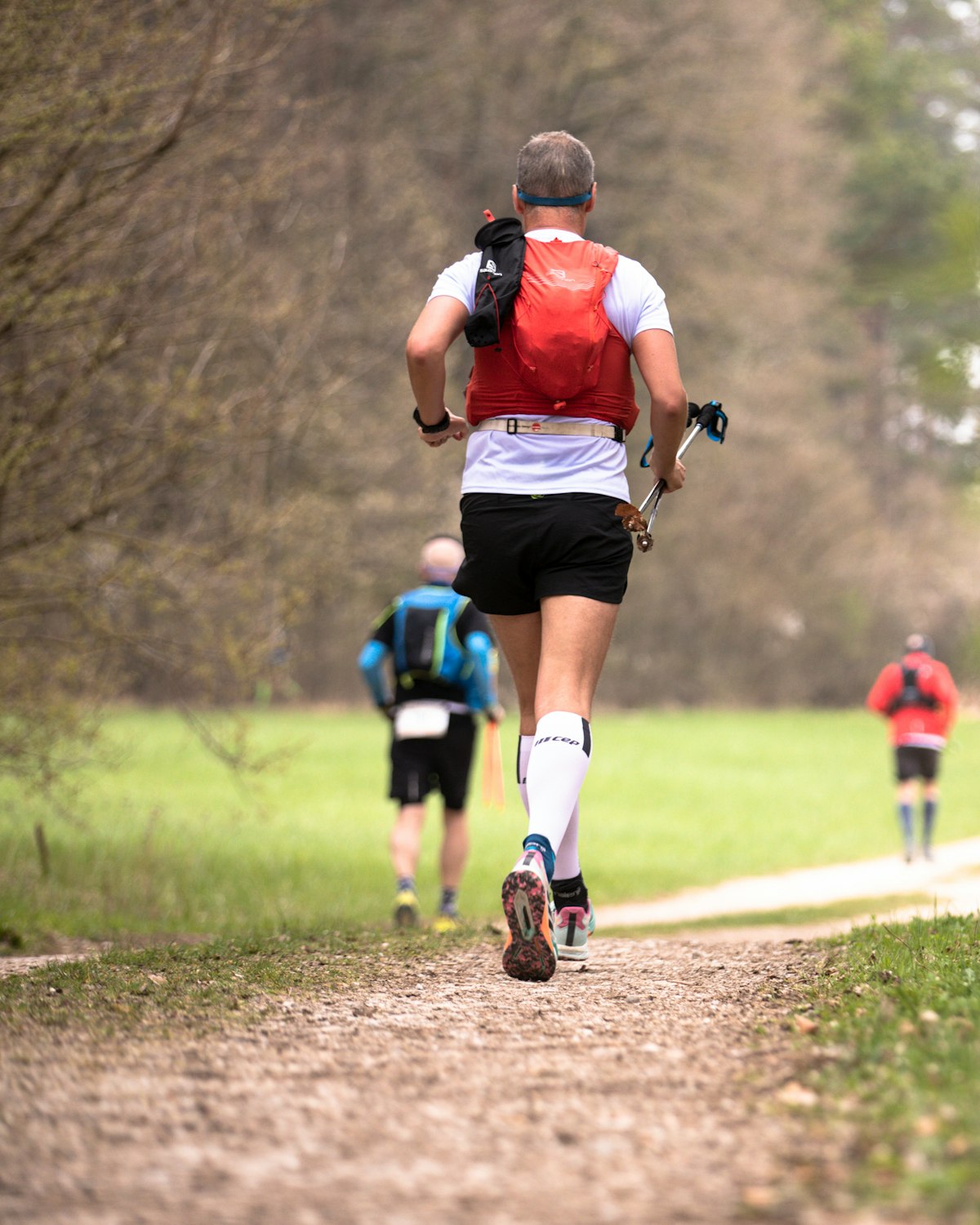
About Kar Spor İda Ultra 2026
Kar Spor İda Ultra 2026 is a trail race held from Fri, Nov 27, 2026 to Sun, Nov 29, 2026 in Güre, Edremit, Balıkesir.
Registration is open; the deadline is Mon, Nov 16, 2026. Dates, registration windows and fees on this page are refreshed every morning by scanning federation, timing and organiser sites; registration always happens on the official race site.
Someone running 30 km a week needs 23 weeks, about 5.5 months, to prepare for the 105K İda Ultra course of Kar Spor İda Ultra 2026; that start day was Fri, Jun 19, 2026, so the window has passed with 6 weeks left to the race.
A trail race run in the Kaz Mountains, rising from the Edremit district of Balıkesir. Courses range from 8.5 kilometers to 105 kilometers; the longest route has a total elevation gain of 4,113 meters and a time limit of 22 hours. The distances bear mythological names such as Zeus, Hades, Poseidon, Afrodit and Hera. The region is largely covered by forest; the upper slopes host the Kazdağı fir, which grows only in these mountains, while lower down there are oak, chestnut and beech communities.
Courses
| Course | Distance | Elevation Gain | Km-effort | ITRA | Fee | Course file |
|---|---|---|---|---|---|---|
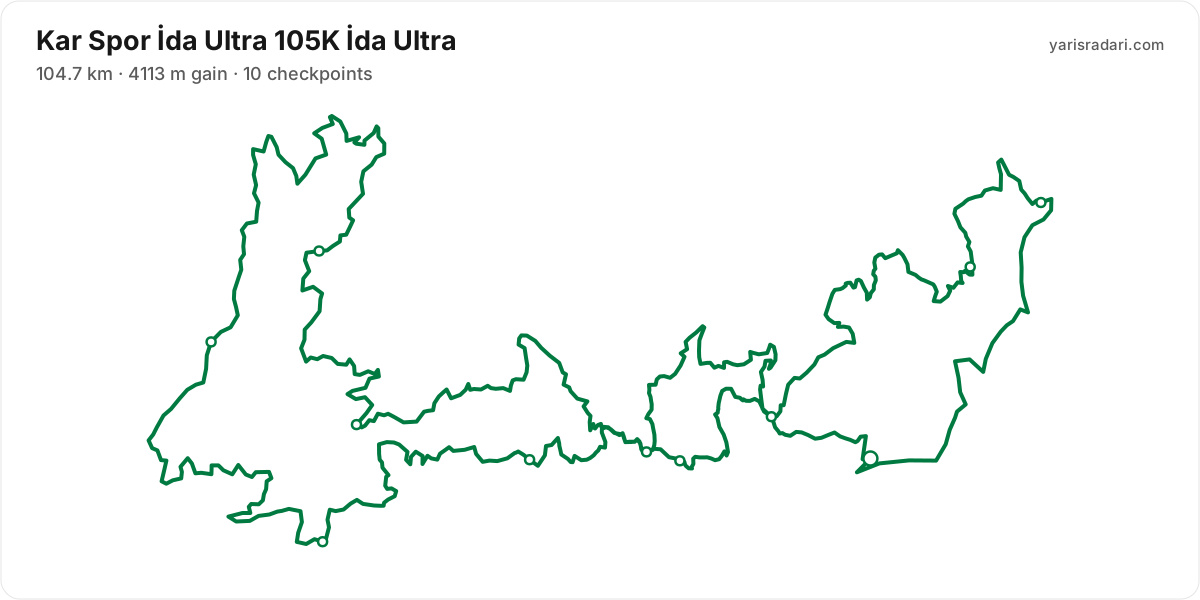
| 105K İda Ultra | 104.7 km | 4113 m D+ | 146 | 4 | 6,000 ₺ | GPX |
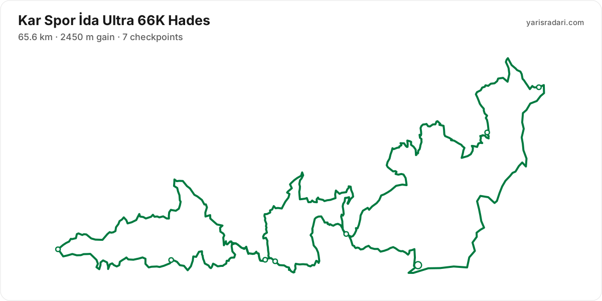
| 66K Hades | 65.6 km | 2450 m D+ | 90 | 3 | 5,000 ₺ | GPX |
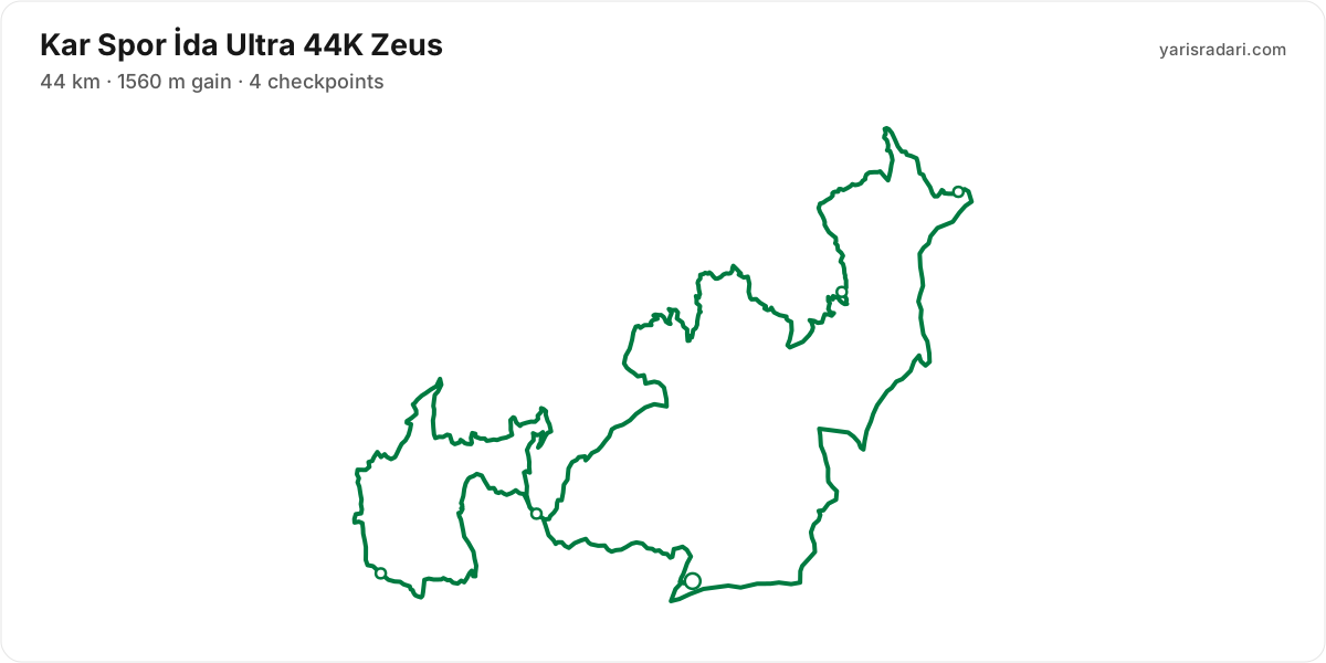
| 44K Zeus | 44 km | 1560 m D+ | 60 | 2 | 4,500 ₺ | GPX |
| 30K Poseidon | 29.5 km | 995 m D+ | 39 | 4,000 ₺ | GPX | |
| 15K Afrodit | 15.5 km | 611 m D+ | 22 | 3,500 ₺ | GPX | |
| 8.5K Hera | 8.5 km | 197 m D+ | 10 | 2,500 ₺ | GPX |
A federation fee is added to these prices at registration.
There are 6 courses: 105K İda Ultra (104.7 km, 4113 m D+, 4 ITRA); 66K Hades (65.6 km, 2450 m D+, 3 ITRA); 44K Zeus (1560 m D+, 2 ITRA); 30K Poseidon (29.5 km, 995 m D+); 15K Afrodit (15.5 km, 611 m D+); 8.5K Hera (197 m D+).
Course map and elevation profile
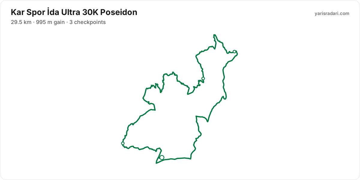
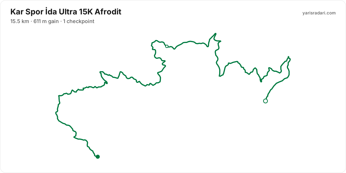
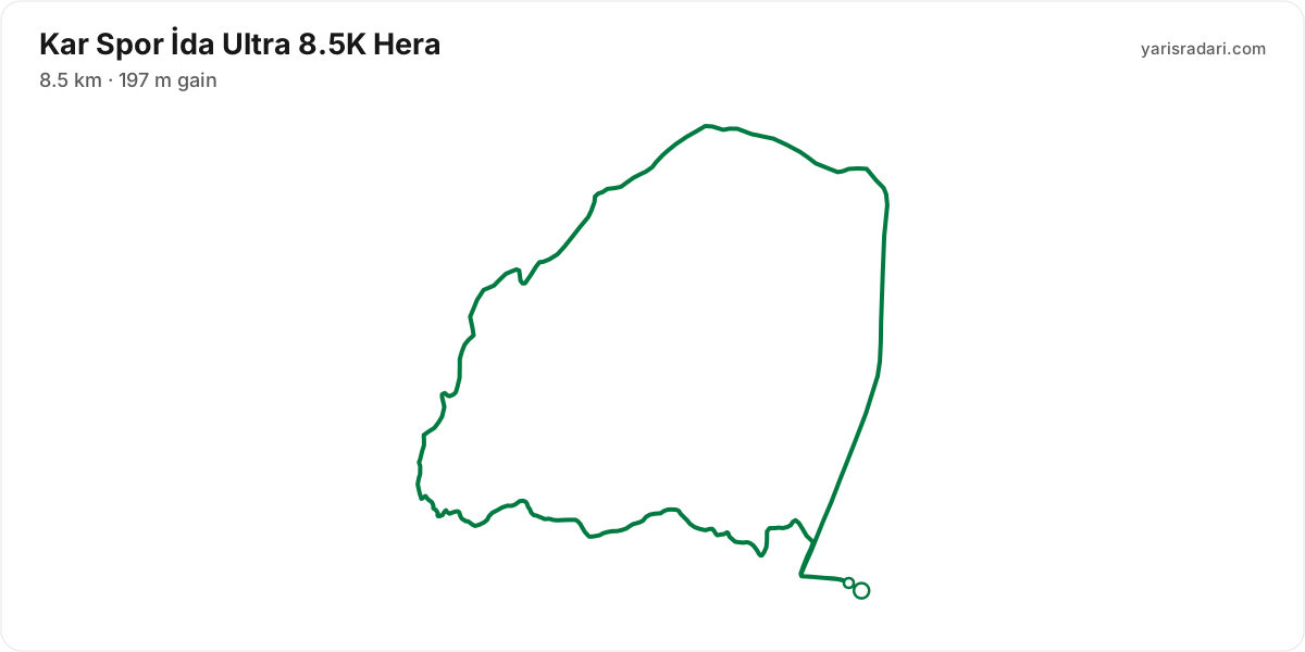
What the weather is usually like here
- Over the last 5 years this week typically ran 9°C to 15°C here, with a high of 20°C and a low of 1°C.
- 69% of those days saw rain. A real forecast lands about two weeks out and will appear here then.
- Typical daily maximum wind was 18 km/h (a light breeze), with 38 km/h the highest value in the sample.
- Sunrise 08:10, sunset 17:49.
The race is more than two weeks out, so these are averages of recent years for the same week, not a forecast. A real forecast appears here closer to the day.
Race briefing
105K İda Ultra course104 km · 4113 m gain · 10 aid stations
The station table gives 105 km with 4113 m of climbing, 39 m per km. The same table lists 4112 m of descent. By leg totals, roughly 57% of the gain sits in the first half.
The steepest leg runs Kışladağ to Ahşap Teras: 8 km for 555 m, 69 m per km, 78% above the course average. This is hiking terrain. Walking it costs less than the minutes you would burn forcing it.
The last 8.2 km still climb 271 m, 33 m per km. It does not end where you first see the finish banner, so save something for it.
These are leg totals. The table does not say where inside a leg the climbing sits, so the steep parts of a leg will be harder than its average.
- Sunset is 17:49 and the finish cut-off is 06:00. A runner using the full time allowance spends the final 12 hours 11 minutes in darkness.
- Get the headtorch out before sunset and keep spare batteries or a power bank dry and immediately accessible. A spare buried at the bottom of the pack is not an emergency spare.
- Check reflective course markers regularly in the dark. If the markings disappear, stop moving forward, return to the last marker and confirm the route against the GPX or organiser app.
- Poles are strongly recommended for this profile. The table gives 39 m of gain per km and the heaviest leg runs at 69 m per km. If you have trained with them and the organiser allows them, they can help share the load on the climbs.
The organiser's GPX file has no elevation data, so the grade profile and kilometre analysis cannot be shown for this course; climb figures come from the aid station table.
Aid stations
Key decision points
Kavurmacılarkm 15
- Collect food and fluids and leave within 60-90 seconds.
- A heavy leg is next: 11 km with 463 m of climbing.
- Cut-off: 3h after the start.
Çamlıbelkm 26
- Take hot food you digest easily and top up fluids.
- A heavy leg is next: 9.3 km with 325 m of climbing.
- Cut-off: 4h 30m after the start.
Kavlaklarkm 36
- Collect food and fluids and leave within 60-90 seconds.
- The heaviest leg is next: 11 km with 679 m of climbing.
- Cut-off: 6h 30m after the start.
Kışladağkm 47
- Collect food and fluids and leave within 60-90 seconds.
- A heavy leg is next: 8 km with 555 m of climbing.
- Cut-off: 9h after the start.
Ahşap Teraskm 55
- Take hot food you digest easily and top up fluids.
- Your drop bag waits here; work off your prepared list.
- A heavy leg is next: 15 km with 515 m of climbing.
- The longest unsupported stretch starts here: 15 km. Leave with full capacity.
- Cut-off: 10h 30m after the start.
Sanayikm 83
- Take hot food you digest easily and top up fluids.
- A heavy leg is next: 8.4 km with 466 m of climbing.
- Cut-off: 16h after the start.
Kavlaklarkm 97
- Collect food and fluids and leave within 60-90 seconds.
- A heavy leg is next: 8.2 km with 271 m of climbing.
- Cut-off: 20h after the start.
- The longest stretch between official aid stations runs from Ahşap Teras (km 55) to Seyir Terası (km 70): 15 km, with 515 m of climbing in between. Top up at Ahşap Teras and size what you carry to the expected duration and your own drinking rate.
- Hot food is served at Çamlıbel (km 26) and Ahşap Teras (km 55) and 1 more. If your stomach and race plan call for it, make this a deliberate 3-5 minute stop; do not sit down simply because hot food is available. Restart gently and let your stomach settle before lifting the effort.
- Food is available at Beyoba (km 10) and Kavurmacılar (km 15) and 5 more. Decide what you need before reaching the table; without a planned special task, collect food and fluids and leave within 60-90 seconds. Finish eating on the next calm, suitable section.
- Drop bag at Ahşap Teras (km 55). Write down the equipment and food you expect to replace before the race so the decision is already made when you arrive.
- The last aid station is Kavlaklar (km 97), leaving 8 km to the finish. After that you are on what you carry.
- The heaviest leg runs from Kavlaklar (km 36) to Kışladağ (km 47): 11 km with 679 m of climbing. Treat it as the slowest part of your day and get your food out before it.
- Medical support is available at Kavurmacılar (km 15), Çamlıbel (km 26), and Güre (km 105). If something is wrong with your feet or your stomach, deal with it there rather than pushing on.
- The overall cut-off is 22h, including all checkpoint stops. Build the plan around the official leg budgets below, not a flat-course average pace.
- Relative to distance and climbing, the tightest official time budget runs from Kavurmacılar (km 15) to Çamlıbel (km 26): the official time budget is 1h 30m for 11 km and 463 m of climbing. Station stops come out of that same budget, so do not enter the leg already behind schedule.
Official cut-off ladder
| Leg | Distance | D+ | Official time budget | Closes |
|---|---|---|---|---|
| Start → Beyoba | 10 km | 271 m | 2h | start + 2h |
| Beyoba → Kavurmacılar | 5 km | 226 m | 1h | start + 3h |
| Kavurmacılar → Çamlıbel | 11 km | 463 m | 1h 30m | start + 4h 30m |
| Çamlıbel → Kavlaklar | 9.3 km | 325 m | 2h | start + 6h 30m |
| Kavlaklar → Kışladağ | 11 km | 679 m | 2h 30m | start + 9h |
| Kışladağ → Ahşap Teras | 8 km | 555 m | 1h 30m | start + 10h 30m |
| Ahşap Teras → Seyir Terası | 15 km | 515 m | 3h | start + 13h 30m |
| Seyir Terası → Sanayi | 13 km | 150 m | 2h 30m | start + 16h |
| Sanayi → Dedepınar | 8.4 km | 466 m | 2h | start + 18h |
| Dedepınar → Kavlaklar | 5.4 km | 192 m | 2h | start + 20h |
| Kavlaklar → Güre | 8.2 km | 271 m | 2h | start + 22h |
Budgets are derived from the cut-off times published by the organiser; they are not a personal finish estimate.
| Station | Km | From previous | Supplies | Medical | Cut-off |
|---|---|---|---|---|---|
| Güre | 0 | — | — | — | — |
| Beyoba | 10 | 10 | Food | No | 2h |
| Kavurmacılar | 15 | 5 | Food | Yes | 3h |
| Çamlıbel | 26 | 11 | Hot food | Yes | 4h 30m |
| Kavlaklar | 36 | 9.3 | Food | No | 6h 30m |
| Kışladağ | 47 | 11 | Food | No | 9h |
| Ahşap TerasDrop bag | 55 | 8 | Hot food | No | 10h 30m |
| Seyir Terası | 70 | 15 | Food | No | 13h 30m |
| Sanayi | 83 | 13 | Hot food | No | 16h |
| Dedepınar | 91 | 8.4 | Food | No | 18h |
| Kavlaklar | 97 | 5.4 | Food | No | 20h |
| GüreDrop bag | 105 | 8.2 | Food | Yes | 22h |
Aid station details come from the list published by the organiser; confirm them at the official source before race day.
Plan your cutoffs for this course
66K Hades course65 km · 2450 m gain · 7 aid stations
The station table gives 66 km with 2450 m of climbing, 37 m per km. The same table lists 2497 m of descent. By leg totals, roughly 48% of the gain sits in the first half.
Leg by leg: the first 10 km for 271 m (Beyoba), the next 5 km for 226 m (Kavurmacılar), the next 11 km for 463 m (Çamlıbel), the next 9.3 km for 325 m (Kavlaklar), the next 11 km for 679 m (Kışladağ), the next 5 km for 20 m (Dedepınar), the next 5.4 km for 192 m (Kavlaklar), the last 8.2 km for 271 m (Güre).
The steepest leg runs Kavlaklar to Kışladağ: 11 km for 679 m, 60 m per km, 61% above the course average. A serious climbing leg. Drop a gear here and pick it back up on the descent.
The last 8.2 km still climb 271 m, 33 m per km. It does not end where you first see the finish banner, so save something for it.
These are leg totals. The table does not say where inside a leg the climbing sits, so the steep parts of a leg will be harder than its average.
- Sunset is 17:49 and the finish cut-off is 20:30. A runner using the full time allowance spends the final 2 hours 41 minutes in darkness.
- Get the headtorch out before sunset and keep spare batteries or a power bank dry and immediately accessible. A spare buried at the bottom of the pack is not an emergency spare.
- Check reflective course markers regularly in the dark. If the markings disappear, stop moving forward, return to the last marker and confirm the route against the GPX or organiser app.
- Organiser rule: Athletes who start with poles must carry them to the finish; abandoning them results in a 30-minute time penalty.
- Poles are strongly recommended for this profile. The table gives 37 m of gain per km and the heaviest leg runs at 60 m per km. If you have trained with them and the organiser allows them, they can help share the load on the climbs.
The organiser's GPX file has no elevation data, so the grade profile and kilometre analysis cannot be shown for this course; climb figures come from the aid station table.
Aid stations
Key decision points
Beyobakm 10
- Collect food and fluids and leave within 60-90 seconds.
- Crew access is allowed here.
- Cut-off: 2h after the start.
Kavurmacılarkm 15
- Collect food and fluids and leave within 60-90 seconds.
- Crew access is allowed here.
- A heavy leg is next: 11 km with 463 m of climbing.
- Cut-off: 3h after the start.
Çamlıbelkm 26
- Collect food and fluids and leave within 60-90 seconds.
- Crew access is allowed here.
- A heavy leg is next: 9.3 km with 325 m of climbing.
- Cut-off: 4h 30m after the start.
Kavlaklarkm 36
- Collect food and fluids and leave within 60-90 seconds.
- Crew access is allowed here.
- The heaviest leg is next: 11 km with 679 m of climbing.
- The longest unsupported stretch starts here: 11 km. Leave with full capacity.
- Cut-off: 6h 30m after the start.
Dedepınarkm 52
- Take hot food you digest easily and top up fluids.
- Your drop bag waits here; work off your prepared list.
- Crew access is allowed here.
- Cut-off: 10h after the start.
Kavlaklarkm 57
- Collect food and fluids and leave within 60-90 seconds.
- Crew access is allowed here.
- A heavy leg is next: 8.2 km with 271 m of climbing.
- Cut-off: 11h 30m after the start.
- The longest stretch between official aid stations runs from Kavlaklar (km 36) to Kışladağ (km 47): 11 km, with 679 m of climbing in between. Top up at Kavlaklar and size what you carry to the expected duration and your own drinking rate.
- Hot food is served at Dedepınar (km 52). If your stomach and race plan call for it, make this a deliberate 3-5 minute stop; do not sit down simply because hot food is available. Restart gently and let your stomach settle before lifting the effort.
- Food is available at Beyoba (km 10) and Kavurmacılar (km 15) and 4 more. Decide what you need before reaching the table; without a planned special task, collect food and fluids and leave within 60-90 seconds. Finish eating on the next calm, suitable section.
- Drop bag at Dedepınar (km 52). Write down the equipment and food you expect to replace before the race so the decision is already made when you arrive.
- Crew support is permitted only at Beyoba (km 10), Kavurmacılar (km 15), Çamlıbel (km 26), Kavlaklar (km 36), Kışladağ (km 47), Dedepınar (km 52), and Kavlaklar (km 57). This is not the same as a drop bag: plan equipment and food hand-offs around these stations, then verify wristband, bag and transport rules with the organiser.
- The last aid station is Kavlaklar (km 57), leaving 8 km to the finish. After that you are on what you carry.
- Another heavy leg runs from Kavurmacılar (km 15) to Çamlıbel (km 26): 11 km with 463 m of climbing. Treat it as the slowest part of your day and get your food out before it.
- Medical support is available at Güre (km 66). If something is wrong with your feet or your stomach, deal with it there rather than pushing on.
- The overall cut-off is 12h 30m, including all checkpoint stops. Build the plan around the official leg budgets below, not a flat-course average pace.
- Relative to distance and climbing, the tightest official time budget runs from Kavlaklar (km 57) to Güre (km 66): the official time budget is 1h for 8 km and 270 m of climbing. Station stops come out of that same budget, so do not enter the leg already behind schedule.
Official cut-off ladder
| Leg | Distance | D+ | Official time budget | Closes |
|---|---|---|---|---|
| Start → Beyoba | 10 km | 271 m | 2h | start + 2h |
| Beyoba → Kavurmacılar | 5 km | 226 m | 1h | start + 3h |
| Kavurmacılar → Çamlıbel | 11 km | 463 m | 1h 30m | start + 4h 30m |
| Çamlıbel → Kavlaklar | 9.3 km | 325 m | 2h | start + 6h 30m |
| Kavlaklar → Kışladağ | 11 km | 679 m | 2h 30m | start + 9h |
| Kışladağ → Dedepınar | 5 km | 20 m | 1h | start + 10h |
| Dedepınar → Kavlaklar | 5.4 km | 196 m | 1h 30m | start + 11h 30m |
| Kavlaklar → Güre | 8.2 km | 270 m | 1h | start + 12h 30m |
Budgets are derived from the cut-off times published by the organiser; they are not a personal finish estimate.
| Station | Km | From previous | Supplies | Medical | Crew | Cut-off |
|---|---|---|---|---|---|---|
| Güre | 0 | — | — | — | — | — |
| Beyoba | 10 | 10 | Food | No | Yes | 2h |
| Kavurmacılar | 15 | 5 | Food | No | Yes | 3h |
| Çamlıbel | 26 | 11 | Food | No | Yes | 4h 30m |
| Kavlaklar | 36 | 9.3 | Food | No | Yes | 6h 30m |
| Kışladağ | 47 | 11 | Food | No | Yes | 9h |
| DedepınarDrop bag | 52 | 5 | Hot food | No | Yes | 10h |
| Kavlaklar | 57 | 5.4 | Food | No | Yes | 11h 30m |
| GüreDrop bag | 66 | 8.2 | Food | Yes | — | 12h 30m |
Aid station details come from the list published by the organiser; confirm them at the official source before race day.
Plan your cutoffs for this course
44K Zeus course44 km · 1560 m gain · 4 aid stations
The station table gives 44 km with 1560 m of climbing, 35 m per km. The same table lists 1638 m of descent. By leg totals, roughly 50% of the gain sits in the first half.
Leg by leg: the first 10 km for 271 m (Beyoba), the next 5 km for 226 m (Kavurmacılar), the next 11 km for 463 m (Çamlıbel), the next 9.3 km for 325 m (Kavlaklar), the last 8.4 km for 275 m (Güre).
The steepest leg runs Beyoba to Kavurmacılar: 5 km for 226 m, 45 m per km, 29% above the course average. A serious climbing leg. Drop a gear here and pick it back up on the descent.
The last 8.4 km drop 502 m. Spend whatever is left, but your quads will already be cooked.
These are leg totals. The table does not say where inside a leg the climbing sits, so the steep parts of a leg will be harder than its average.
- Cut-off lands at 18:30 and sunset at 17:49, near enough the same moment. Go slower than planned and the last kilometres are in the dark, so pack the torch.
- Poles are strongly recommended for this profile. The table gives 35 m of gain per km and the heaviest leg runs at 45 m per km. If you have trained with them and the organiser allows them, they can help share the load on the climbs.
The organiser's GPX file has no elevation data, so the grade profile and kilometre analysis cannot be shown for this course; climb figures come from the aid station table.
Aid stations
Key decision points
Kavurmacılarkm 15
- Collect food and fluids and leave within 60-90 seconds.
- The heaviest leg is next: 11 km with 463 m of climbing.
- The longest unsupported stretch starts here: 11 km. Leave with full capacity.
- Cut-off: 3h after the start.
Çamlıbelkm 26
- Collect food and fluids and leave within 60-90 seconds.
- A heavy leg is next: 9.3 km with 325 m of climbing.
- Cut-off: 4h 30m after the start.
Kavlaklarkm 36
- Collect food and fluids and leave within 60-90 seconds.
- A heavy leg is next: 8.4 km with 275 m of climbing.
- Cut-off: 6h 30m after the start.
- The longest stretch between official aid stations runs from Kavurmacılar (km 15) to Çamlıbel (km 26): 11 km, with 463 m of climbing in between. Top up at Kavurmacılar and size what you carry to the expected duration and your own drinking rate.
- Food is available at Beyoba (km 10) and Kavurmacılar (km 15) and 2 more. Decide what you need before reaching the table; without a planned special task, collect food and fluids and leave within 60-90 seconds. Finish eating on the next calm, suitable section.
- The last aid station is Kavlaklar (km 36), leaving 8 km to the finish. After that you are on what you carry.
- Another heavy leg runs from Çamlıbel (km 26) to Kavlaklar (km 36): 9 km with 325 m of climbing. Treat it as the slowest part of your day and get your food out before it.
- Medical support is available at Beyoba (km 10). If something is wrong with your feet or your stomach, deal with it there rather than pushing on.
- The overall cut-off is 8h 30m, including all checkpoint stops. Build the plan around the official leg budgets below, not a flat-course average pace.
- Relative to distance and climbing, the tightest official time budget runs from Kavurmacılar (km 15) to Çamlıbel (km 26): the official time budget is 1h 30m for 11 km and 463 m of climbing. Station stops come out of that same budget, so do not enter the leg already behind schedule.
Official cut-off ladder
| Leg | Distance | D+ | Official time budget | Closes |
|---|---|---|---|---|
| Start → Beyoba | 10 km | 271 m | 2h | start + 2h |
| Beyoba → Kavurmacılar | 5 km | 226 m | 1h | start + 3h |
| Kavurmacılar → Çamlıbel | 11 km | 463 m | 1h 30m | start + 4h 30m |
| Çamlıbel → Kavlaklar | 9.3 km | 325 m | 2h | start + 6h 30m |
| Kavlaklar → Güre | 8.4 km | 275 m | 2h | start + 8h 30m |
Budgets are derived from the cut-off times published by the organiser; they are not a personal finish estimate.
| Station | Km | From previous | Supplies | Medical | Cut-off |
|---|---|---|---|---|---|
| Güre | 0 | — | — | — | — |
| Beyoba | 10 | 10 | Food | Yes | 2h |
| Kavurmacılar | 15 | 5 | Food | No | 3h |
| Çamlıbel | 26 | 11 | Food | No | 4h 30m |
| Kavlaklar | 36 | 9.3 | Food | No | 6h 30m |
| Güre | 44 | 8.4 | Food | — | 8h 30m |
Aid station details come from the list published by the organiser; confirm them at the official source before race day.
Plan your cutoffs for this course
30K Poseidon course29 km · 995 m gain · 3 aid stations
The station table gives 30 km with 995 m of climbing, 34 m per km. The same table lists 985 m of descent. By leg totals, roughly 49% of the gain sits in the first half.
Leg by leg: the first 10 km for 271 m (Beyoba), the next 5 km for 226 m (Kavurmacılar), the next 11 km for 463 m (Çamlıbel), the last 3.2 km for 30 m (Güre).
The steepest leg runs Beyoba to Kavurmacılar: 5 km for 226 m, 45 m per km, 33% above the course average. A serious climbing leg. Drop a gear here and pick it back up on the descent.
The last 3.2 km drop 172 m. Spend whatever is left, but your quads will already be cooked.
These are leg totals. The table does not say where inside a leg the climbing sits, so the steep parts of a leg will be harder than its average.
- Even at cut-off pace you finish 1 hour 49 minutes before sunset. This one is run entirely in daylight.
- Poles are strongly recommended for this profile. The table gives 34 m of gain per km and the heaviest leg runs at 45 m per km. If you have trained with them and the organiser allows them, they can help share the load on the climbs.
The organiser's GPX file has no elevation data, so the grade profile and kilometre analysis cannot be shown for this course; climb figures come from the aid station table.
Aid stations
Key decision points
Kavurmacılarkm 15
- Collect food and fluids and leave within 60-90 seconds.
- The heaviest leg is next: 11 km with 463 m of climbing.
- The longest unsupported stretch starts here: 11 km. Leave with full capacity.
- Cut-off: 3h after the start.
- The longest stretch between official aid stations runs from Kavurmacılar (km 15) to Çamlıbel (km 26): 11 km, with 463 m of climbing in between. Top up at Kavurmacılar and size what you carry to the expected duration and your own drinking rate.
- Food is available at Beyoba (km 10) and Kavurmacılar (km 15) and 1 more. Decide what you need before reaching the table; without a planned special task, collect food and fluids and leave within 60-90 seconds. Finish eating on the next calm, suitable section.
- Another heavy leg runs from Güre (km 0) to Beyoba (km 10): 10 km with 271 m of climbing. Treat it as the slowest part of your day and get your food out before it.
- Medical support is available at Beyoba (km 10). If something is wrong with your feet or your stomach, deal with it there rather than pushing on.
- The overall cut-off is 6h, including all checkpoint stops. Build the plan around the official leg budgets below, not a flat-course average pace.
- Relative to distance and climbing, the tightest official time budget runs from Kavurmacılar (km 15) to Çamlıbel (km 26): the official time budget is 1h 30m for 11 km and 463 m of climbing. Station stops come out of that same budget, so do not enter the leg already behind schedule.
Official cut-off ladder
| Leg | Distance | D+ | Official time budget | Closes |
|---|---|---|---|---|
| Start → Beyoba | 10 km | 271 m | 2h | start + 2h |
| Beyoba → Kavurmacılar | 5 km | 226 m | 1h | start + 3h |
| Kavurmacılar → Çamlıbel | 11 km | 463 m | 1h 30m | start + 4h 30m |
| Çamlıbel → Güre | 3.2 km | 35 m | 1h 30m | start + 6h |
Budgets are derived from the cut-off times published by the organiser; they are not a personal finish estimate.
| Station | Km | From previous | Supplies | Medical | Cut-off |
|---|---|---|---|---|---|
| Güre | 0 | — | — | — | — |
| Beyoba | 10 | 10 | Food | Yes | 2h |
| Kavurmacılar | 15 | 5 | Food | No | 3h |
| Çamlıbel | 26 | 11 | Food | No | 4h 30m |
| Güre | 30 | 3.2 | Food | — | 6h |
Aid station details come from the list published by the organiser; confirm them at the official source before race day.
Plan your cutoffs for this course
15K Afrodit course15 km · 611 m gain · 1 aid station
The station table gives 16 km with 611 m of climbing, 39 m per km. The same table lists 523 m of descent. By leg totals, roughly 53% of the gain sits in the first half.
Leg by leg: the first 8 km for 332 m (Çetmibaşı Su Noktası), the last 7.5 km for 279 m (Adatepe).
The steepest leg runs Yeşilyurt to Çetmibaşı Su Noktası: 8 km for 332 m, 42 m per km. A serious climbing leg. Drop a gear here and pick it back up on the descent.
The last 7.5 km still climb 279 m, 37 m per km. It does not end where you first see the finish banner, so save something for it.
These are leg totals. The table does not say where inside a leg the climbing sits, so the steep parts of a leg will be harder than its average.
- Even at cut-off pace you finish 4 hours 50 minutes before sunset. This one is run entirely in daylight.
- Poles are strongly recommended for this profile. The table gives 39 m of gain per km and the heaviest leg runs at 42 m per km. If you have trained with them and the organiser allows them, they can help share the load on the climbs.
- Point to point: the finish sits 4.4 km from the start as the crow flies. Sort the shuttle and your drop bag before race day.
The organiser's GPX file has no elevation data, so the grade profile and kilometre analysis cannot be shown for this course; climb figures come from the aid station table.
Aid stations
- The longest gap between official aid stations is 8 km, with 332 m of climbing in between, from Yeşilyurt (km 0) to Çetmibaşı Su Noktası (km 8). Split your fluid accordingly.
- Drinks only, no food, at Çetmibaşı Su Noktası (km 8). Loosen the flask caps on approach; with no queue, refill and leave in 20-30 seconds. Carry the food you will need from the previous station.
- The last aid station is Çetmibaşı Su Noktası (km 8), leaving 8 km to the finish. After that you are on what you carry.
- Another heavy leg runs from Çetmibaşı Su Noktası (km 8) to Adatepe (km 16): 8 km with 279 m of climbing. Treat it as the slowest part of your day and get your food out before it.
- The overall cut-off is 3h, including all checkpoint stops. Build the plan around the official leg budgets below, not a flat-course average pace.
| Station | Km | From previous | Supplies | Medical | Cut-off |
|---|---|---|---|---|---|
| Yeşilyurt | 0 | — | — | — | — |
| Çetmibaşı Su Noktası | 8 | 8 | Water | No | — |
| AdatepeDrop bag | 16 | 7.5 | Food | No | 3h |
Aid station details come from the list published by the organiser; confirm them at the official source before race day.
Plan your cutoffs for this course
8.5K Hera course9 km · 197 m gain
- Even at cut-off pace you finish 6 hours 49 minutes before sunset. This one is run entirely in daylight.
The organiser's GPX file has no elevation data, so the grade profile and kilometre analysis cannot be shown for this course; climb figures come from the aid station table.
Aid stations
- The longest gap between official aid stations is 9 km, with 197 m of climbing in between, from Güre (km 0) to Güre (km 9). Split your fluid accordingly.
- The overall cut-off is 2h, including all checkpoint stops. Build the plan around the official leg budgets below, not a flat-course average pace.
| Station | Km | From previous | Cut-off |
|---|---|---|---|
| Güre | 0 | — | — |
| Güre | 8.5 | 8.5 | 2h |
Aid station details come from the list published by the organiser; confirm them at the official source before race day.
Plan your cutoffs for this course
2024 results
- In 2024, 1,160 runners completed the race across 5 courses.
- 42 runners started the 109.8 km course and 26 finished, 38% did not finish, the winner took 12:54:16 and the median was 15:40:49, nine in ten finishers came in under 18:56:04.
- 89 runners started the 66 km course and 85 finished, 4% did not finish, the winner took 6:32:41 and the median was 9:39:35, nine in ten finishers came in under 11:50:52.
- 336 runners started the 36.7 km course and 311 finished, 7% did not finish, the winner took 2:57:57 and the median was 5:00:05, nine in ten finishers came in under 6:15:31.
- 537 runners started the 15.5 km course and 535 finished, 0% did not finish, the winner took 1:07:54 and the median was 2:10:00, nine in ten finishers came in under 2:49:07.
- 205 runners started the 8.5 km course and 203 finished, 1% did not finish, the winner took 37:16 and the median was 1:08:33, nine in ten finishers came in under 1:36:03.
| Course | Finished / started | Did not finish | Winner | Median |
|---|---|---|---|---|
| 109.8 kmIDA ULTRA 110K | 26 / 42 | 38% | 12:54:16 | 15:40:49 |
| 66 kmIDA HALF ULTRA 66K | 85 / 89 | 4% | 6:32:41 | 9:39:35 |
| 36.7 kmRUN ZEUS 36K | 311 / 336 | 7% | 2:57:57 | 5:00:05 |
| 15.5 kmKÖY KOŞUSU 15K | 535 / 537 | 0% | 1:07:54 | 2:10:00 |
| 8.5 kmSEKİZ BUÇUK 8.5K | 203 / 205 | 1% | 37:16 | 1:08:33 |
Calculators for this race
Data sources: PassTiming race calendar, TAF private road races, official site (idaultra.com) · Last checked:
Organising this race? See how to correct details and complete this page
Tune-up races
Prep races you can run in the weeks before this one, ahead of your taper.
Similar races
Frequently asked questions
(29)
What is Kar Spor İda Ultra?
A trail race run in the Kaz Mountains, rising from the Edremit district of Balıkesir. Courses range from 8.5 kilometers to 105 kilometers; the longest route has a total elevation gain of 4,113 meters and a time limit of 22 hours. The distances bear mythological names such as Zeus, Hades, Poseidon, Afrodit and Hera. The region is largely covered by forest; the upper slopes host the Kazdağı fir, which grows only in these mountains, while lower down there are oak, chestnut and beech communities.
When is Kar Spor İda Ultra 2026?
Kar Spor İda Ultra takes place on Fri, Nov 27, 2026 - Sun, Nov 29, 2026.
Where does Kar Spor İda Ultra take place?
Kar Spor İda Ultra takes place in Güre, Edremit, Balıkesir.
What are the courses and distances of Kar Spor İda Ultra 2026?
Kar Spor İda Ultra offers 6 courses: 105K İda Ultra (104.7 km, 4113 m D+, 4 ITRA); 66K Hades (65.6 km, 2450 m D+, 3 ITRA); 44K Zeus (44 km, 1560 m D+, 2 ITRA); 30K Poseidon (29.5 km, 995 m D+); 15K Afrodit (15.5 km, 611 m D+); 8.5K Hera (8.5 km, 197 m D+).
How hard is Kar Spor İda Ultra 2026?
Difficulty is measured in km-effort: distance plus ascent divided by 100. The 105K İda Ultra course covers 104.7 km with 4113 m of climbing, which is 146 km-effort and falls in ITRA category L. All courses: 105K İda Ultra 146 km-effort (L), 66K Hades 90 km-effort (M), 44K Zeus 60 km-effort (S), 30K Poseidon 39 km-effort (XS), 15K Afrodit 22 km-effort (XXS), 8.5K Hera 10 km-effort (XXS).
Is registration for Kar Spor İda Ultra 2026 open?
Registration appears to be open; the deadline is Mon, Nov 16, 2026.
When is the registration deadline for Kar Spor İda Ultra 2026?
The registration deadline for Kar Spor İda Ultra is Mon, Nov 16, 2026.
What is the official website of Kar Spor İda Ultra?
Official website: https://www.idaultra.com/
Is a medical certificate required for Kar Spor İda Ultra?
The requirement does not apply to everyone. See the organiser's official page for the exact wording.
Is the Kar Spor İda Ultra 2026 course a loop or an out and back?
The 105K İda Ultra course is a single loop with a shared start and finish; measured from the GPX file it runs 104.1 km. The 66K Hades course is a single loop with a shared start and finish; measured from the GPX file it runs 65.3 km. The 44K Zeus course is a single loop with a shared start and finish; measured from the GPX file it runs 43.7 km.
Where is the hardest section at Kar Spor İda Ultra 2026?
The steepest leg of the 105K İda Ultra course runs km 47 to km 55: 8 km for 555 m, 69 m per km. The figures come from the organiser's aid station table.
How much climbing does Kar Spor İda Ultra 2026 have?
The 105K İda Ultra course covers 105 km with 4113 m of climbing according to the station table, 39 m per km. The same table lists 4112 m of descent.
Do you need poles at Kar Spor İda Ultra 2026?
The 105K İda Ultra course averages 39 m of gain per km, rising to 69 m on the heaviest leg, so poles help noticeably.
Do you need a headtorch at Kar Spor İda Ultra 2026?
105K İda Ultra: Sunset is 17:49 and the finish cut-off is 06:00. A runner using the full time allowance spends the final 12 hours 11 minutes in darkness. Get the headtorch out before sunset and keep spare batteries or a power bank dry and immediately accessible. A spare buried at the bottom of the pack is not an emergency spare. Check reflective course markers regularly in the dark. If the markings disappear, stop moving forward, return to the last marker and confirm the route against the GPX or organiser app.
What is the weather like at Kar Spor İda Ultra 2026?
Over the last 5 years the same week here measured 9°C to 15°C, with a high of 20°C, a low of 1°C and rain on 69% of days. A real forecast lands about two weeks out.
Where are the aid stations at Kar Spor İda Ultra 2026?
The 105K İda Ultra course has 10 stations; the first at km 10 and the last at km 97. The longest gap between them is 15 km, between Ahşap Teras and Seyir Terası.
What is served at the Kar Spor İda Ultra 2026 aid stations?
For the 105K İda Ultra course: Hot food: Çamlıbel (26. km), Ahşap Teras (55. km), Sanayi (83. km).
Is there a drop bag at Kar Spor İda Ultra 2026?
Yes. On the 105K İda Ultra course the drop bag point is Ahşap Teras (km 55).
What are the cut-off times for the 105K İda Ultra at Kar Spor İda Ultra 2026?
On the 105K İda Ultra course at Kar Spor İda Ultra 2026 the finish cut-off is 22h. Intermediate cut-offs: Beyoba (km 10) 2h, Kavurmacılar (km 15) 3h, Çamlıbel (km 26) 4h 30m, Kavlaklar (km 36) 6h 30m, Kışladağ (km 47) 9h, Ahşap Teras (km 55) 10h 30m, Seyir Terası (km 70) 13h 30m, Sanayi (km 83) 16h, Dedepınar (km 91) 18h, Kavlaklar (km 97) 20h.
What are the cut-off times for the 66K Hades at Kar Spor İda Ultra 2026?
On the 66K Hades course at Kar Spor İda Ultra 2026 the finish cut-off is 12h 30m. Intermediate cut-offs: Beyoba (km 10) 2h, Kavurmacılar (km 15) 3h, Çamlıbel (km 26) 4h 30m, Kavlaklar (km 36) 6h 30m, Kışladağ (km 47) 9h, Dedepınar (km 52) 10h, Kavlaklar (km 57) 11h 30m.
What are the cut-off times for the 44K Zeus at Kar Spor İda Ultra 2026?
On the 44K Zeus course at Kar Spor İda Ultra 2026 the finish cut-off is 8h 30m. Intermediate cut-offs: Beyoba (km 10) 2h, Kavurmacılar (km 15) 3h, Çamlıbel (km 26) 4h 30m, Kavlaklar (km 36) 6h 30m.
What are the cut-off times for the 30K Poseidon at Kar Spor İda Ultra 2026?
On the 30K Poseidon course at Kar Spor İda Ultra 2026 the finish cut-off is 6h. Intermediate cut-offs: Beyoba (km 10) 2h, Kavurmacılar (km 15) 3h, Çamlıbel (km 26) 4h 30m.
What time does Kar Spor İda Ultra 2026 start?
Known start times: 105K İda Ultra 08:00, 66K Hades 08:00, 44K Zeus 10:00, 30K Poseidon 10:00, 15K Afrodit 10:00, 8.5K Hera 09:00, local time. Confirm against the organiser's schedule in race week.
What is the time limit at Kar Spor İda Ultra 2026?
The finish time limit is 105K İda Ultra 22h, 66K Hades 12h 30m, 44K Zeus 8h 30m, 30K Poseidon 6h. Intermediate stations carry their own cut-offs; the full list is in the checkpoint table on this page.
Is there a GPX file for Kar Spor İda Ultra 2026?
Yes. The GPX files for the 105K İda Ultra, 66K Hades, 44K Zeus, 30K Poseidon, 15K Afrodit, 8.5K Hera courses can be downloaded from the course section on this page, next to the route map. Where the organiser's GPX file has no elevation data, there is no grade profile.
Which Kar Spor İda Ultra course should you choose?
The shortest option is 8.5K Hera (8.5 km, 197 m D+) and the longest is 105K İda Ultra (104.7 km, 4113 m D+). With little trail experience the 8.5K Hera is the safer start; the 105K İda Ultra demands an all-day effort and cut-off management.
How many ITRA points does Kar Spor İda Ultra 2026 give?
ITRA points: 105K İda Ultra 4 ITRA, 66K Hades 3 ITRA, 44K Zeus 2 ITRA. These points count towards entry requirements for UTMB style races.
Are the Kar Spor İda Ultra 2026 cut-offs hard to make?
Making the 105K İda Ultra finish cut-off needs an average of 12.6 minutes per km, aid stops included. Even a brisk hike stays inside the limit.
Do you need to carry water at Kar Spor İda Ultra 2026?
Yes: the longest stretch without aid on the 105K İda Ultra course is 15 km, so carrying backup water is essential.